 Quoterra
AI Site Mapping for Commercial Landscapers: Boundaries, Objects, and Human Approval
How AI site mapping helps commercial landscape estimators set boundaries, detect grass, trees, and shrubs, and approve quantities before they hit the estimate—without treating map parity as the whole bid.
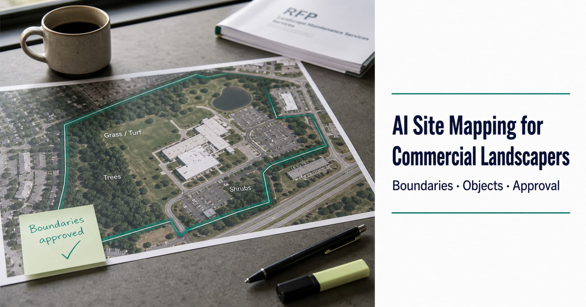
The RFP told you the park is “about twelve acres of turf.” Your measuring wheel, last year’s takeoff, and the satellite layer on your screen all disagree—by enough acres to matter.
That gap is where commercial landscape bids quietly go wrong. Not always because the estimator can’t measure. Because the site truth and the RFP packet live in different tools, and quantities get retyped between them under deadline pressure.
AI site mapping—AI-driven detection of service boundaries and landscape objects (grass, trees, shrubs, and related assets)—is how more estimating desks are closing that gap. Used well, it is a measurement step with human approval gates. Used poorly, it becomes another takeoff bake-off that ignores the packet that started the bid.
This guide is for estimators and bid managers who price commercial and municipal landscape work: what AI site mapping actually does, where human approval belongs, and how it fits the rest of the bid loop—not how to win a map-feature contest against dedicated aerial takeoff tools.
Why “measure the acre” isn’t the whole job
Commercial landscape RFPs ask for more than a pretty polygon:
- Where the work is (addresses, parcels, road segments, campus zones)
- What counts (turf, beds, trees, hardscape, irrigation zones—depending on scope)
- What the packet requires (frequencies, standards, exclusions, forms)
A strong takeoff without a traced requirement list still produces a fragile bid. A perfect compliance matrix without defensible quantities still produces a fragile price. Mid-market desks feel both pains in the same week.
That is why Quoterra’s product narrative puts AI Site Mapping after Rapid Extraction and before the Estimator—not as a standalone “map product.” The map step feeds quantities into estimating; it does not replace reading the RFP.
Related reading: Commercial landscape RFPs: how to read & respond and the 17-category RFP checklist.
What AI site mapping means
For commercial landscapers, AI site mapping usually means some combination of:
- Placing sites from the RFP — Addresses or location cues extracted from the packet become map placements for review
- Defining service boundaries — Property limits, beds, road-adjacent zones, or maintenance areas your team draws or adjusts
- Detecting landscape objects — Models that label assets such as grass/turf, trees, shrubs (and, depending on product depth, hardscape or irrigation-related zones) from imagery
- Producing quantities — Areas and counts that can flow into line items
Two phrases matter in governance-friendly copy:
- Auto boundaries — Suggested or detected edges; still subject to estimator approval
- Object detection — Labels on landscape assets; still subject to estimator approval
Neither phrase means “the AI bids for you.” Quantities that hit a price sheet without a human gate are a risk transfer, not a feature.
The approval gates that keep map AI honest
Treat AI site mapping like a supervised takeoff—not a black box.
| Gate | What the estimator checks |
|---|---|
| Geocode / site placement | Is this the right property, campus, or segment? |
| Boundary approval | Do the polygons match what you will actually maintain or install? |
| Object / quantity review | Do grass, tree, and shrub outputs match known sites and RFP scope? |
| Reconcile to the packet | Does the RFP’s stated acreage or inventory conflict with measurement? |
If the RFP says 12 acres and your approved map says 9, that is not an automatic “win.” It is a question for addenda or a documented assumption—same discipline you already use with field visits and manual GIS.
Rule of thumb: Measurement should not run—or should not lock—until boundaries your team owns are in place. Segmentation that waits on boundary approval keeps quality under human control.
How this differs from “another takeoff tool”
The market for landscape measurement is crowded: aerial takeoff specialists, plan-set CV tools, suite-native PropertyIntel-style measure-and-price, and spreadsheets. Many of them are excellent at map.
Where commercial bid desks still lose time is continuity:
RFP packet → structured requirements → approved site quantities → estimate line items → submission package
If your firm already has a measurement source of record (for example a DFY aerial takeoff provider), the strategic question is rarely “rip it out.” It is whether the packet-to-estimate loop still forces retyping, missed obligations, and disconnected submission chase.
Category contrast—not vendor bashing:
| Approach | Strength | Where it often stops |
|---|---|---|
| Dedicated aerial / takeoff SoR | Deep measurement, QA layers, CRM sync | May not own messy RFP extraction → estimate → package |
| Plan-symbol takeoff | Fast from drawings | Plan symbols ≠ always site truth or RFP text obligations |
| Suite measure-to-price | Catalog and ops gravity | RFP packet front-end still manual |
| AI site mapping inside a bid loop | Boundaries + objects tied to the same bid context | Not a claim of takeoff-parity supremacy |
Positioning to remember: Lead with Extract → Map → Estimate → Bid Package. Do not try to win LM150 bake-offs on Map alone before you have the narrative and references for the full loop.
A practical workflow estimators can copy (tool-agnostic)
Whether you use Quoterra’s AI Site Mapping or another stack, the sequence stays familiar:
- Qualify and extract requirements from the RFP (insurance, scope, sites, forms) into a checklist with page references
- Confirm every site that will be priced—geocodes, names, exhibits
- Set or approve boundaries for service areas before trusting quantities
- Review detected objects against known properties and the written scope
- Reconcile conflicts with the agency via questions/addenda when numbers diverge
- Push approved quantities into estimating—not a parallel spreadsheet that drifts from the map
- Carry context forward into the package so submission isn’t a second scavenger hunt
Steps 2–5 are the mapping chapter. Steps 1 and 6–7 are why mapping alone never finishes the bid.
After the estimate locks, production still needs those quantities in a form crews can build against. (Constructible quantities from estimate to field.)
What good looks like for Alex (estimator) and Jordan (owner)
For the estimating / bid manager:
Fewer hand-traced polygons for every zone, quantities linked to approved areas, and less “rebuild the takeoff in Excel before pricing.” Success is a measurement-backed estimate you can defend in review—not a faster wrong number.
For the owner / principal:
More pursuits per season with the same desk, because measurement and packet work stop stealing the week. Software should expand bid capacity, not demand a rip-and-replace of the ops suite on day one. (More on growing bid capacity. Coexist with Aspire, LMN, or SingleOps.)
How Quoterra frames AI Site Mapping
In Quoterra, AI Site Mapping sits in the commercial landscape bid loop:
- Rapid Extraction — Structure the RFP packet
- AI Site Mapping — Boundaries + landscape object detection with human gates
- Estimator + AI control plane — Quantities and RFP context into line items (more on the control plane)
- Bid Package — Help generate the final package for submission
Map is contested. Continuity is the wedge: the same bid record from packet to package, with your team approving the gates that matter.
Ready to map a live site in context—not in isolation?
If AI site mapping only helps when it connects to the RFP you already extracted and the estimate you still own, see the loop on a real package.
Request a Demo — sales-guided beta, US & Canada. Bring your next commercial landscape RFP if you have one.
Prefer the process map first? See how it works · Explore AI Site Mapping on Features
Useful for your next bid cycle?
Talk with Quoterra